Blues Musicians’ Graves
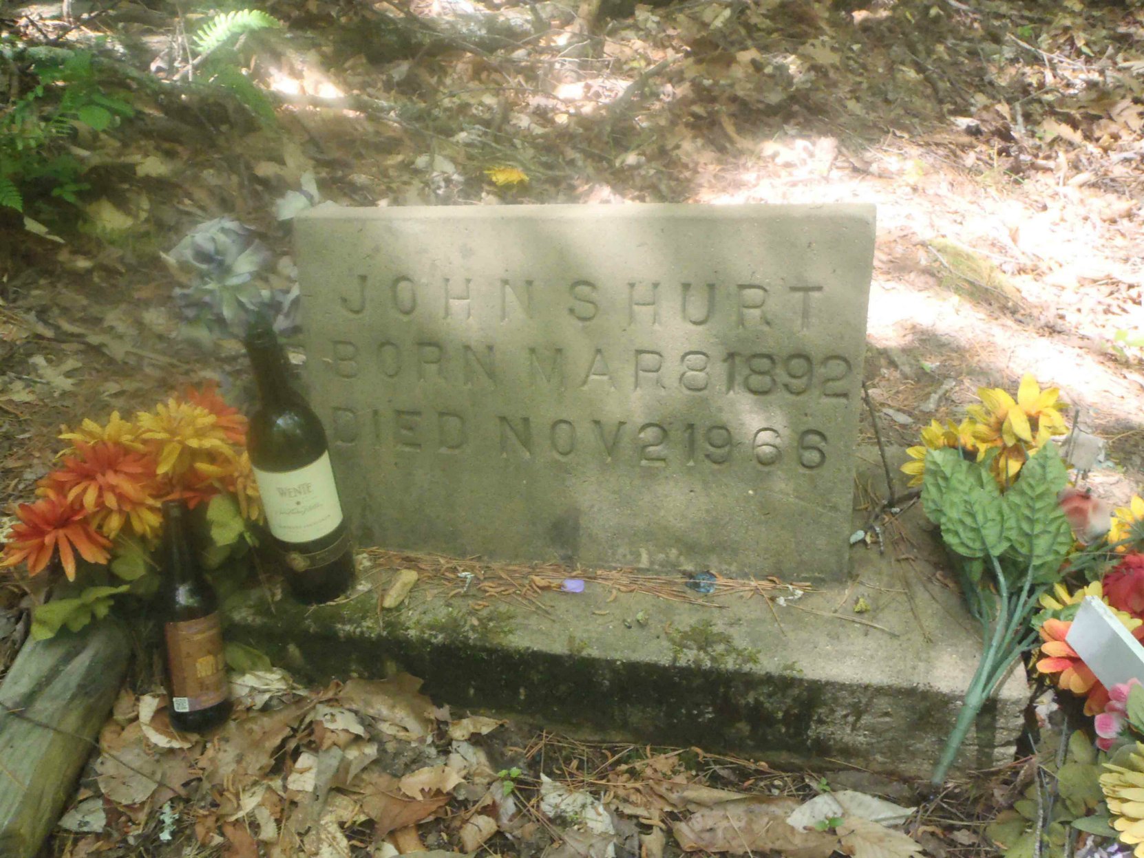
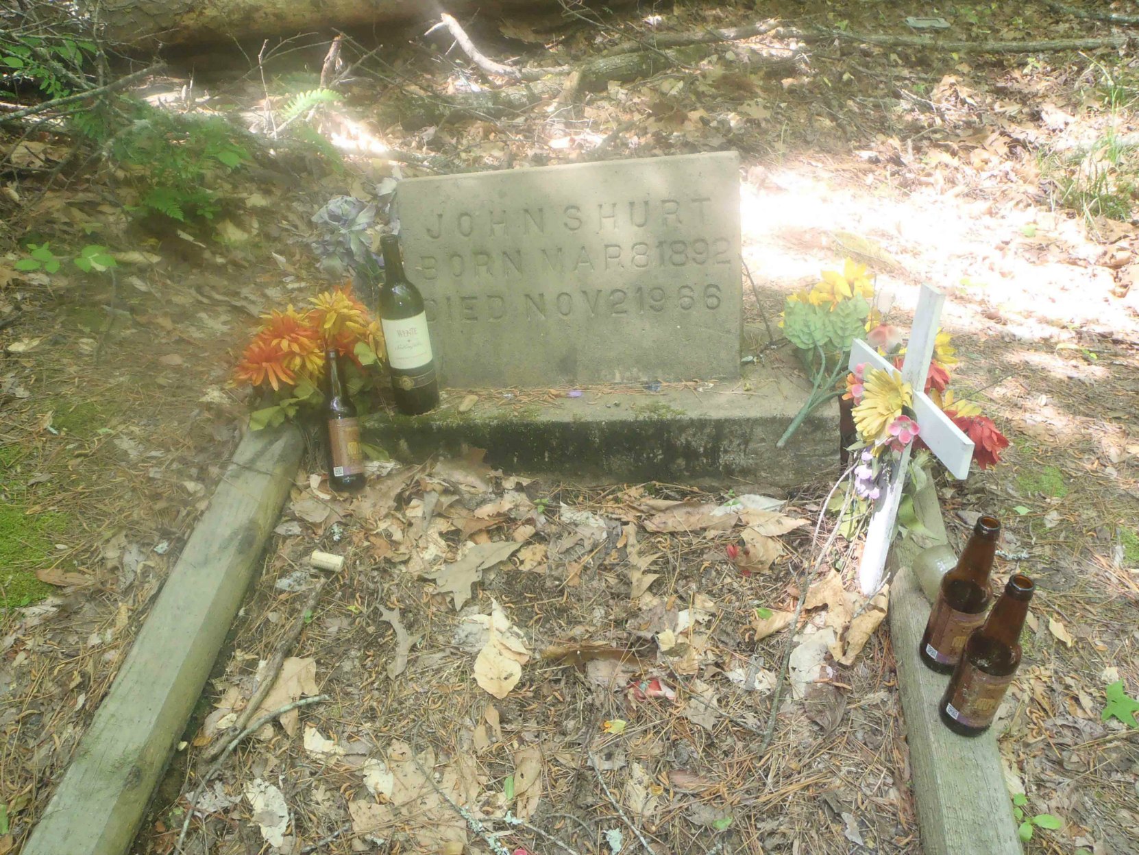
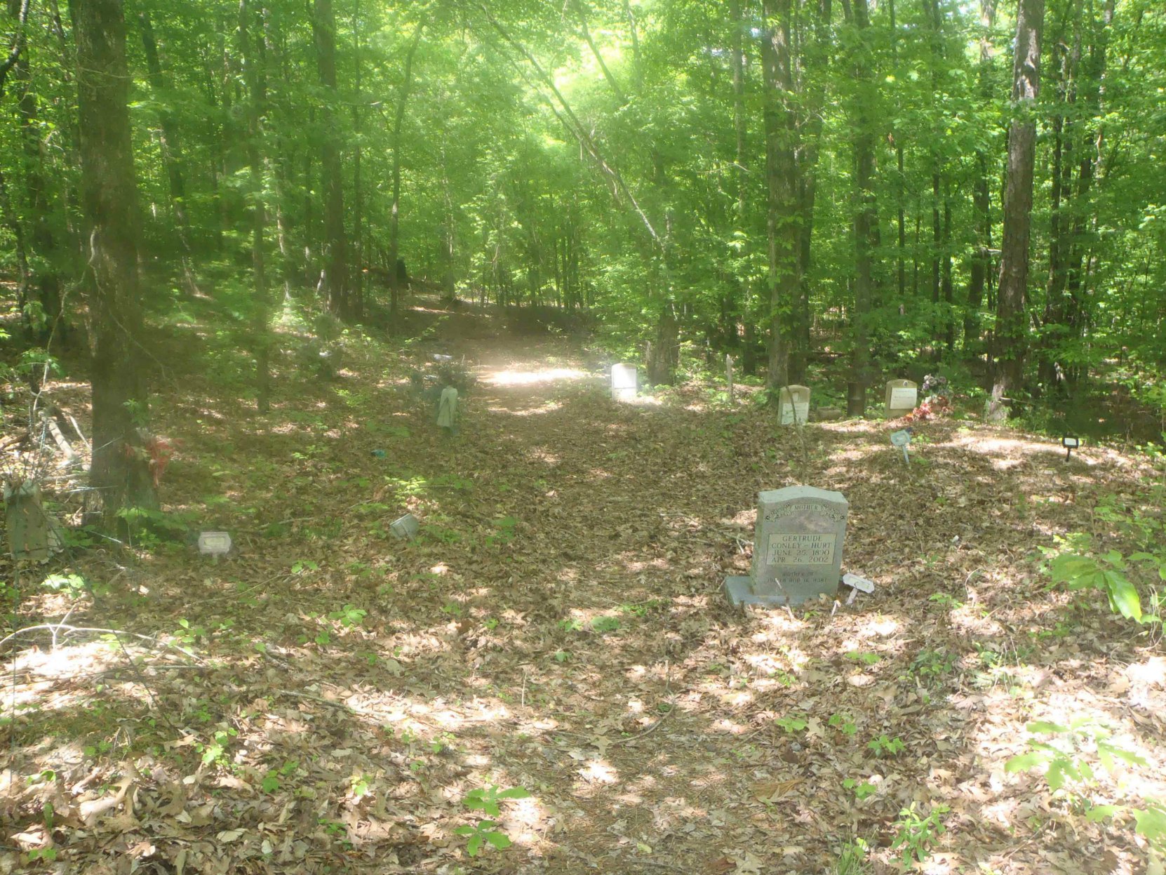
The grave site of Mississippi John Hurt (1892-1966) near Avalon, Mississippi is in an overgrown cemetery that is somewhat difficult to find.
The GPS location of Mississippi John Hurt’s grave is: N 33° 38.823′ W 90° 02.095′
One guide book to Mississippi blues sites actually suggests that it is dangerous to visit Mississippi John Hurt’s grave; it advises visitors to “not stop and ask for directions [to Mississippi John Hurt’s grave] as some of the residents have been openly hostile to what they consider intrusion on their private road.”
We did not experience any hostility from local residents when we went to Mississippi John Hurt’s grave. Quite the contrary, actually; all the local residents we met were very friendly and helpful. That is not to say that others haven’t experienced the kind of hostility described in the guide book, just that we didn’t experience anything like that.
Here are some photos of Mississippi John Hurt’s grave.
Here is a video of Mississippi John Hurt:
Getting To Mississippi John Hurt’s Grave
Mississippi John Hurt’s grave is somewhat difficult to find. It is located in an abandoned, overgrown cemetery on the side of a poorly marked dirt road.
Here are some directions to Mississippi John Hurt’s grave.
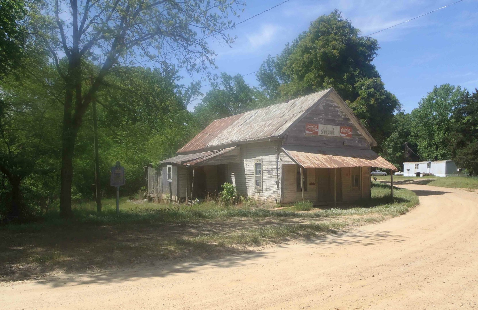
First, get to John Hurt’s home town of Avalon, a small hamlet on Highway 7 in Carroll County, Mississippi.
Here are directions to Mississippi John Hurt’s grave from Highway 7.
There is a Mississippi Department of Archives and History marker about Mississippi John Hurt located at the intersection of Highway 7 and County Road 204 (note: Google Maps refers to this road as County Road 41).
The GPS location of this marker is: N 33° 39.321′ W 90° 05.077′
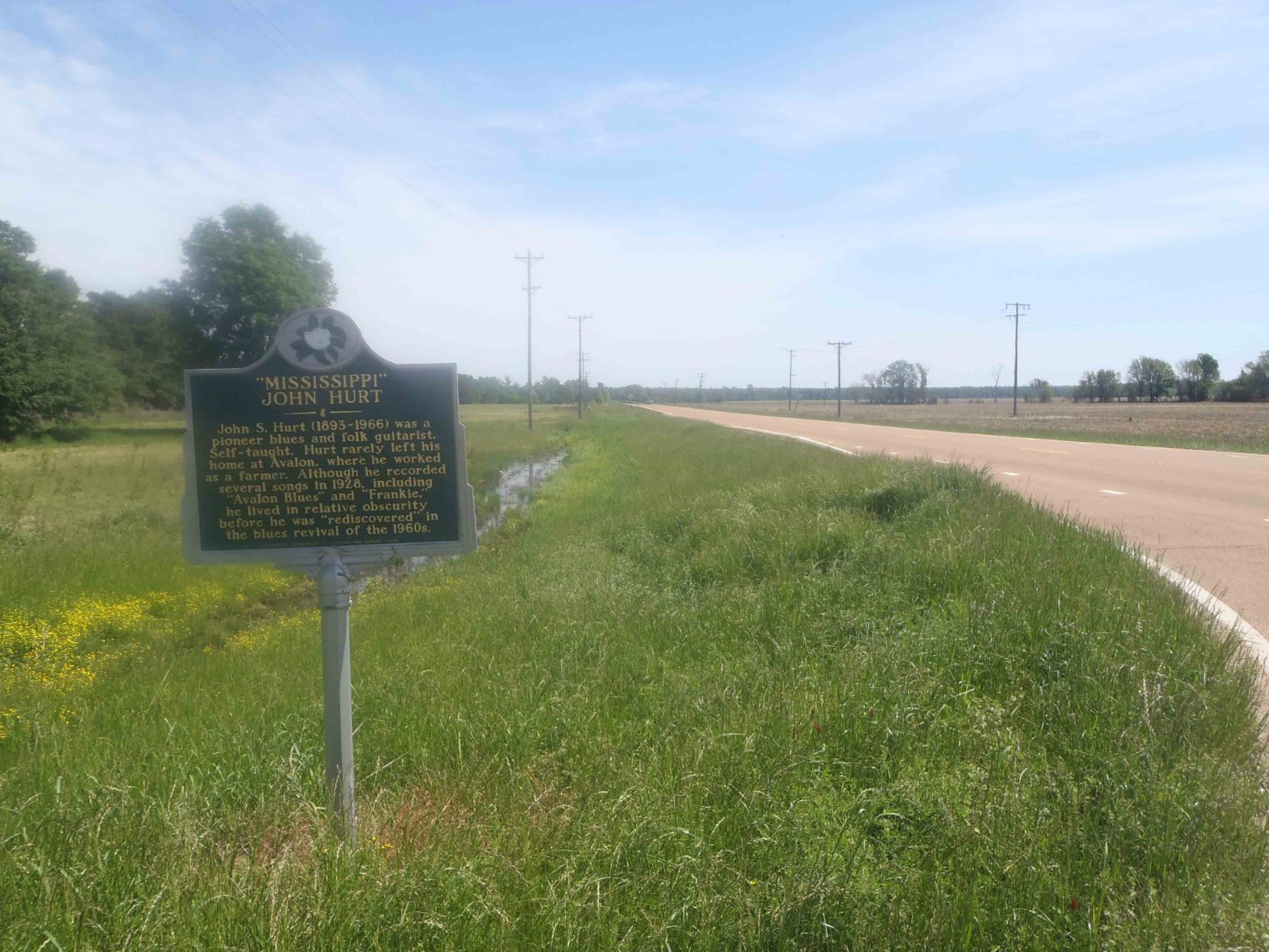
Across Highway 7 from the M.D.A.H. marker, you’ll see Carroll County Road 204 heading east. Take Carroll County Road 204 and drive east. The road eventually curves to the right. Follow the right hand curve. You’ll see a white building to your right just before County Road 204 curves left and starts going up hill. The white building is a church that Mississippi John Hurt used to attend.
Follow the left hand curve in the road as it heads uphill
As County Road 204 goes uphill you’ll come to a steep road heading uphill off the left side of County Road 204. It looks like a driveway to a house on top of the hill but it’s not actually a driveway; it’s a public road leading toward the cemetery where Mississippi John Hurt is buried.
The GPS location for the intersection of this dirt road with County Road 204 is: N 33° 38.101 W 90° 02.412′
Turn left and follow this dirt road. There are houses and driveways on both sides of the road as you drive in toward the cemetery where Mississippi John Hurt is buried.
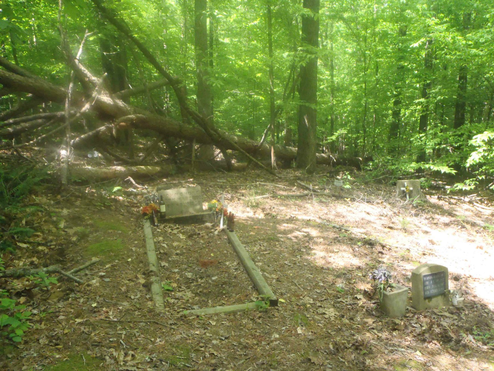
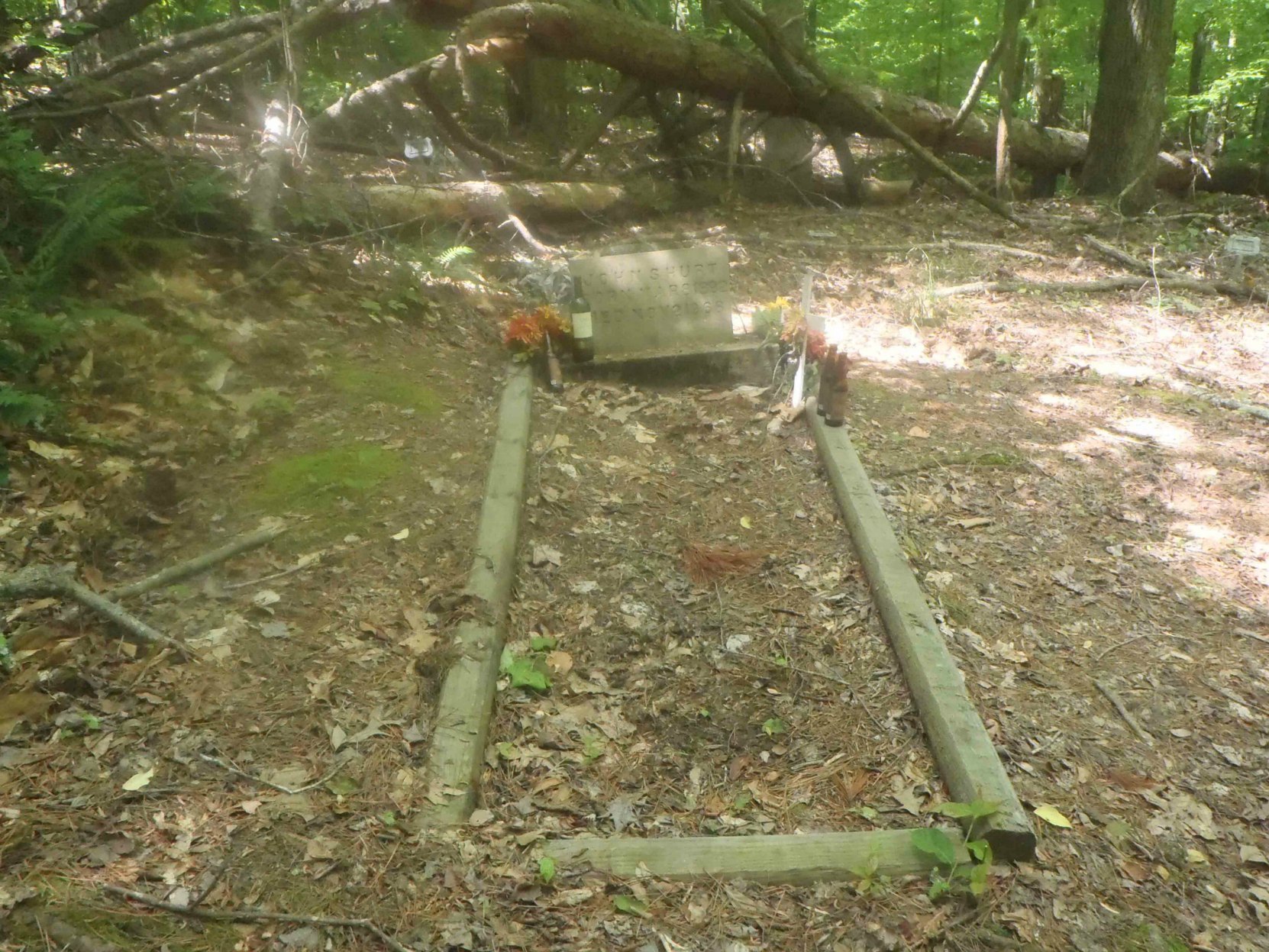
The cemetery in which Mississippi John Hurt is buried is on the left hand side of the road as you drive in toward it. The cemetery is very overgrown and it is difficult to see the graves through the trees.
There is a place you can pull over and park near the cemetery at GPS location: N 33 38.830′ W 90 02.064′
You’ll find a trail leading into the trees from the left side of the road. The GPS location for the point the trail meets the road is: N 33 38.825′ W 90 02.060′
The photo below shows the view from the roadside entrance to the trail. Follow the trail to the back of the cemetery to find Mississippi John Hurt’s grave. The trail to the grave has been fairly well worn by previous visitors so you shouldn’t have much trouble following it once you find the spot where the trail meets the dirt road.
The GPS location of Mississippi John Hurt’s grave is: N 33° 38.823′ W 90° 02.095′
Update:
Some Google Maps Street Views on Getting To Mississippi John Hurt’s Grave
Some of our readers have recently reported having difficulty finding Mississippi John Hurt’s grave using the GPS locations we have shown above. If other readers are experiencing similar difficulties, here are some Google Maps Street View images of the route to the grave. We hope these help resolve some of these reported problems.
First, start off at the Mississippi Department of Archives & History marker at the intersection of Highway 7 and Carroll County Road 41. (note: when we were last there, the road sign on this road said Carroll County Road 204 and we have used that road designation above. To avoid confusion here, we will use the Google Maps reference to County Road 41)
Carroll County Road 41 runs approximately east-west. Turn eastward on Carroll County Road 41 and follow it eastward. County Road 41 eventually curves south but it can be confusing as there is a smaller road which continues straight. Be sure to follow County Road 41 as it curves south. Here is what it looks like as you approach the curve:
Keep following County Road 41 as starts to climb uphill. You will come to a turnoff onto a narrow dirt road leading to the cemetery where Mississippi John Hurt is buried. Here is what the turnoff looks like on Google Street View:
On Google Maps, the road you will take to Mississippi John Hurt’s grave is called St. James Church Road. There are no Google Street View images available for St. James Church Road so we can’t show you a Google Street View image of the cemetery where Mississippi John Hurt is buried.
But you should be able to find the cemetery based on our GPS reading, taken using a Garmin handheld GPS.
Our GPS reading for the location of Mississippi John Hurt’s grave is: N 33° 38.823′ W 90° 02.095′
Here is is our photo of the entrance to the cemetery from the road Google Maps refers to as St. James Church Road:
If our readers think it would be worthwhile for us embed a Google Map on this page showing the location of various local sites related to Mississippi John Hurt, please let us know. You can Contact Us by putting a comment in the dialog box at the bottom of the page.
There is also a Mississippi Blues Trail marker on Carroll County Road 204 commemorating Mississippi John Hurt.
Would you like to leave a comment or question about anything on this page?